How to Make Low-Stress Bike Maps Everywhere
It’s been a few weeks since we launched the first version of Suggest, our tool for folks in any city to work together to make a Low-Stress Bike Map.

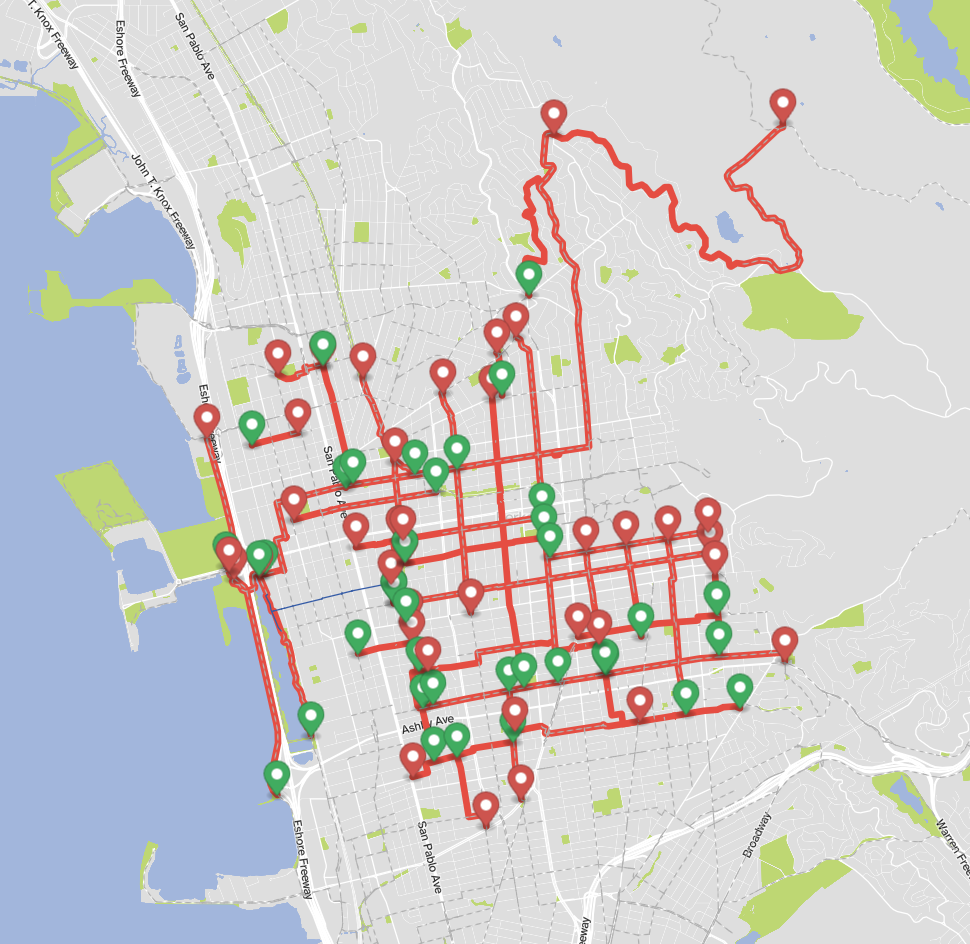
Since then, we’ve been using it in our mapmaking with teams in Wheat Ridge, CO – an addition to the metro Denver map – and Berkeley, CA.
Until now, we’ve been using Google Maps as a drafting tool in our collaborations with folks in other cities, like this one to make the Low-Stress Indianapolis Bike Map.

Here’s our vision for how Low-Stress Bike Maps start to take shape in cities across the country. A group of committed folks, perhaps connected with a local advocacy group like the Dallas Bicycle Coalition, form the core mapping team.
This group starts to Suggest candidate routes – chill routes they already know and love. They add these to the provisional map using the Suggest tool.
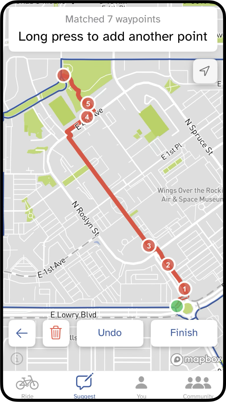
They share these candidate routes with other folks in the community. Those people, in turn, vote and comment on the routes. And they add their own route suggestions.
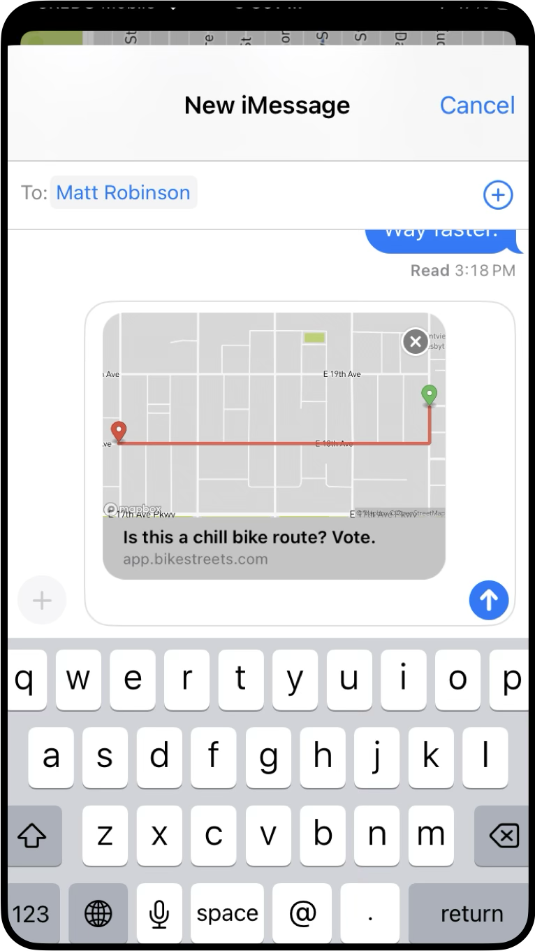
When a route reaches a certain number of votes, the core mapping team makes a decision on whether to add the route to the map.
Once the map of approved routes reaches a certain percentage of coverage in a city – meaning there’s a bona fide network – we’ll publish the map, like this one in Flagstaff, AZ.

Low-Stress Bike Maps are living, breathing documents. As we identify gaps in the network, learn better routes, and as a city builds new high-comfort bike facilities, we add them to the map. It evolves and changes over time.
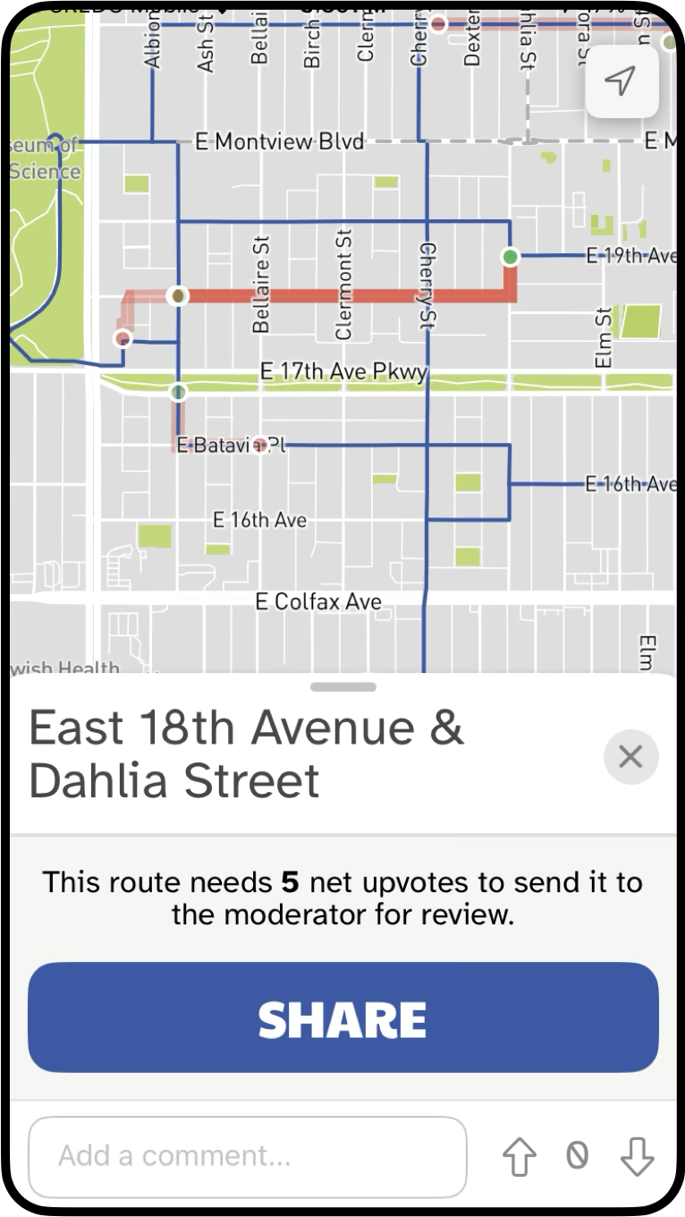
Here’s an example in Denver that shows how small these optimizations can be. The original route headed west on 16th Ave, turned north on Dahlia, and then headed west on Batavia.

Folks pointed out that if you were headed south, it was inefficient to go north on Dahlia to then go south on Cherry. So we added the bottom portion of this box to the map and voila.

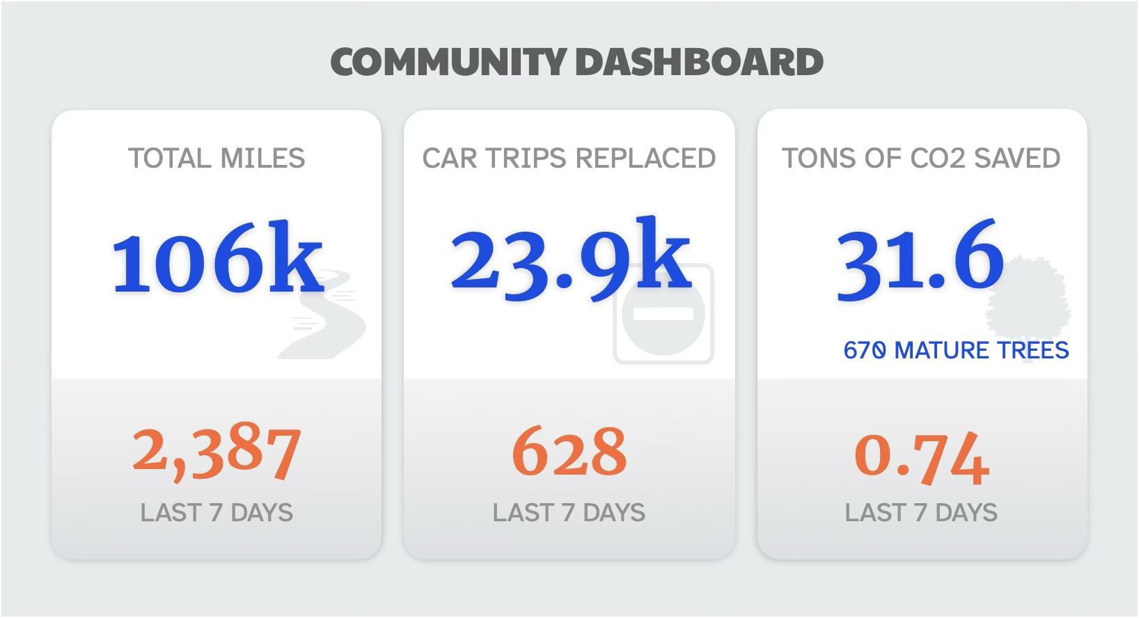
Once we launch a map, it’s about getting as many people as we can to ride the routes, Suggest new ones and refine the existing ones, and add to the miles total on the community dashboard — the collective community voice calling for more investment in infrastructure.